
Data Access
The data used in this project are available for download or for use as web services from NC OneMap.
All electronic and/or hard copy products (maps, data, text, etc.) produced by this landslide hazard mapping program are considered public information and may be freely redistributed and/or copied. These products, however, are intended to serve for general planning purposes only, and are provided on an "as is" basis. These maps and other products are not a substitute for an on-the-ground site assessment by qualified individuals.
Resources
-
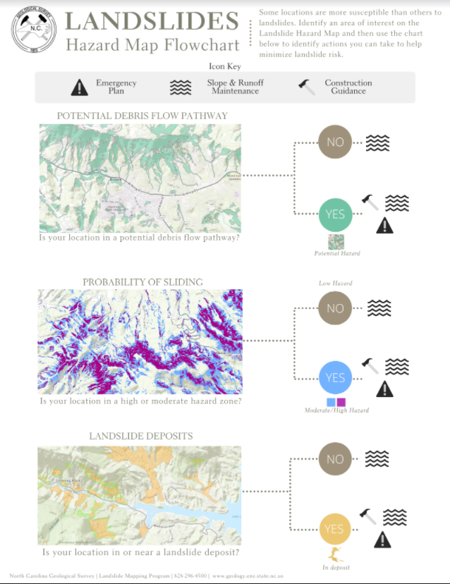 Reducing Landslide RiskUse this brochure to identify actions you can take to recognize and minimize landslide risk
 -
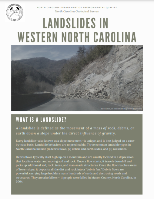 Guide to LandslidesThis four-page brochure provides targeted information about landslides in the region
 -
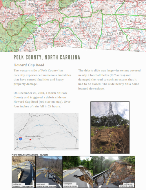 Polk County | Howard Gap RoadThis two-page handout describes the December 2018 landslide event
 -
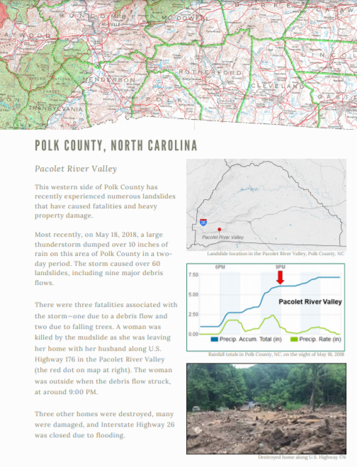 Polk County | Pacolet River ValleyThis two-page handout describes the May 2018 landslide event
Other Supporting Resources
- NCGS Geologic Hazards — LandslidesOfficial North Carolina Geological Survey page on landslide geologic hazards and programs
- Introduction to Landslides in North CarolinaAn introduction to landslides—one of the most common geologic hazards in North Carolina—and the processes behind them
- Criteria for Preliminary Slope Stability AssessmentsSeptember 25, 2019 — This document sets forth the methodology used for assessing slope stability
- NCGS PublicationsExplore interactive maps, geologic maps, and miscellaneous publications from the North Carolina Geological Survey
- Appalachian Landslide Consultants, PLLCRegional partners who have produced an online map viewer and other materials to assist with understanding landslide hazards in western North Carolina